
24 May 2023. Earth Observation for Food Security Conference. By World Bank.
Session 1: Earth Observation Data for Food Security Monitoring Systems
The objective of this session was to feature advances in using EO data and analytics for food security monitoring by the development and research organizations, and reflect on their strengths and weaknesses
- Moderator: Parmesh Shah, Global Lead for Data Driven Digital Agriculture, World Bank
- Tracking Food Security Using Earth Observation - Inbal Becker-Reshef, Program Director, NASA Harvest
- WFPs Early Warning System - Rogerio Bonifacio, Head of the Climate and Earth Observation Team at the WFP
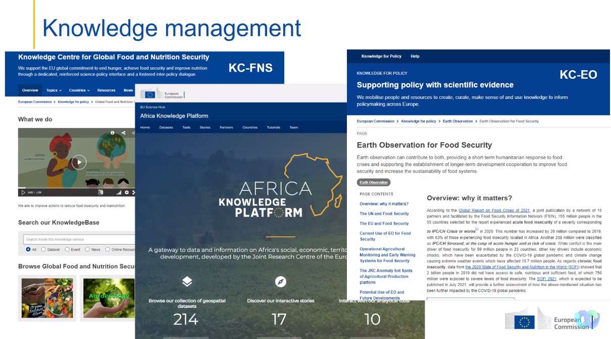
- EO Based Information for Food Security Policy and Decision Support - Felix Rembold (picture), Team Leader, Food Security Joint Research Centre of the European Commission. The other online participants of the Joint Research Center (JRC) were Filip Sabo project officer, Disaster Risk Management (E.1 Unit), Francesco Collivignarelli Scientific Officer, Herve Kerdilis Scientific Officer in charge of Food Security / crop monitoring mainly in Africa.

"There is a component of JRC support to Regional Centers of Excellence (RCoE) in the new AA between JRC and INTPA, related to Earth Observation (EO) (Thematic: Agro-ecological & sustainable agri-food systems (JRC.D4 and D5). " Felix Rembold team Leader Food Security (D.5 Unit)
Presentation by Felix Rembold (see picture) (team Leader Food Security (D.5 Unit)Result 3.5: Better use of Earth Observation in coordination with the COPERNICUS programme. Identification, in collaboration with African Centers of excellence and with ongoing and future initiatives on the sector, of improved use cases of Earth Observation and launch of studies focusing on the use of Earth Observation data and tools for going beyond the productivity aspect of agriculture and focusing more on sustainability aspects. Starting point is the current activity on sustainable Cocoa (Ivory Coast, Ghana and Cameroon) and the ongoing feasibility study about mapping of different tree crops (Cocoa, Rubber, and others) and shading trees in agroforestry systems. Studies can include elements of ecosystems services, digitalization for agriculture and links with mapping of farming".

Session 2: Food Security Monitoring and Response: Experience from the Field
The objective of this session was to feature the use of EO data and analytics for anticipatory action for food security from the public sector side.
- Moderator: Kateryna Schroeder, Senior Agriculture Economist, World Bank
- China’s Advances in Global Crop Monitoring Hongwei Zeng, Associate Professor, CropWatch
- Using EO for Food Security Monitoring: Experience from Kenya - Charles Mwangi, Ag. Director, Space Sector & Technology Development, Kenya Space Agency
- The Global Food and Nutrition Security Dashboard: Informing Crisis Response with Geospatial Data - Alexandra Horst, Senior Economist, World Bank
- The European Space Agency-World Bank Partnership: Pushing the Sustainable Adoption of EO for Food Security - Alex Chunet, European Space Agency Representative, ESA/World Bank
Session 3a: Advances in Earth Observation & Artificial Intelligence for Food Security Monitoring
The objective of this session was to feature organizations doing ground-breaking work in AI and EO data that can be applied to agriculture and food security.
- Moderator: Bruno Sanchez-Andrade Nuno, Consultant, World Bank
- Harnessing AI and Geo Analyses to Address Food Insecurity - Rahul Dodhia, Deputy Director, AI for Good Lab, Microsoft
- Geospatial and AI-enhanced Impact Evaluation of Climate-Sensitive Food Security Outcomes - Rhiannan Price, Chief Strategy and Innovations Officer, DevGlobal
- AI and Open Remote Sensing Data for Crop Monitoring Hamed Alemohammad, Director of Center for Geospatial Analytics, Clark University
Session 3b: Advances in Earth Observation & Artificial Intelligence for Food Security Monitoring
The objective of this session is to feature organizations doing ground-breaking work in AI and EO data that can be applied to agriculture and food security
- Moderator: Lukas Kondmann, Consultant, World Bank
- AI & the Earth Observation Revolution | Teaching the Cloud to See the Earth - Peter Kerins, Data Scientist, Impact Observatory
- The Evolving Role of Ground Data "Label" Collection in Remote Sensing ML-based Estimation Models - Vivek Sakhrani, Vice President, Data & Analytics, Atlas AI
- Scaling the Power of Predictive Crop Analytics for Food Security - Nupur Parikh, VP, Global Impact and Strategic Partnerships, CropIN
Related

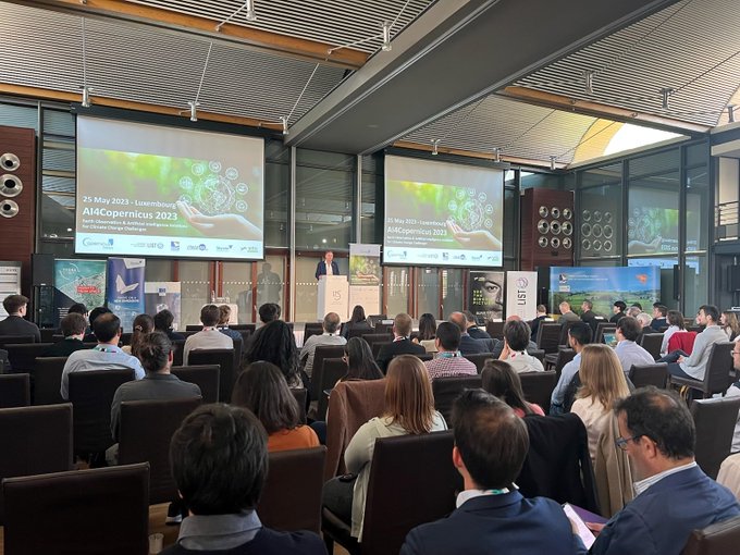
This new edition of the AI4Copernicus event focused on climate change and its impact on energy, food and water security. To withstand current and future pressures on our natural resources, integrated and sustainable management practices are required to balance the needs of people, nature and the economy.
This is the link to the presentations and the posters in PDF for which the organisers received the authorizations from the authors: https://www.ai4copernicus.org/programme/
The AI4Copernicus day offered the opportunity to:
SESSION 1: WELCOME + KEYNOTE SPEAKERS
SESSION 2: CLIMATE CHANGE AND WATER SECURITY
The AI4Copernicus day offered the opportunity to:
- Review the latest technological developments in the use of AI for Earth Observation.
- Get a better idea of the challenges that society is facing in the field of climate change.
- Witness some examples of existing technological implementations of AI and EO to address the issue of water, energy and food security.
- Initiate new collaborations.
SESSION 1: WELCOME + KEYNOTE SPEAKERS
- Thomas Kallstenius, Chief Executive Officer, Luxembourg Institute of Science and Technology
- Seraphine Luneau, German Aerospace Center (DLR), Framework Partnership Agreement on Copernicus User Uptake
- Olivier Dubois, Oscars S.A. ALF (Coalitional) Active Learning Factory
- Davis Tuia, EPFL - Machine learning for the environment: monitoring the pulse of our Planet with remotely sensed data
SESSION 2: CLIMATE CHANGE AND WATER SECURITY
- Paolo Campanella, WASDI Accurate and automatic flood maps based on SAR and optical data
- Heein Yang – Contec Space SARL - Global scale crisis analysis tool: CONTEC Space Studio
- Sergio Albani, SatCenClimate and energy security initiatives at SatCen
- Francesco Bongiovanni, LuxProvide - Making environmental science environmentally friendly: follow the merm(AI)d
- Antoine Halff, Kayrros - Satellites + AI for climate action (remote)
- Franz Fayot, Minister of the Economy
- Thomas Dermine, State Secretary for Science Policy, Recovery Program and Strategic Investments at Belgian Federal Government
SESSION 4: YOUNG RESEARCHER PITCHES
- Bart Beusen, VITO- Swin Transformers and U-Net for remote sensing based surface water monitoring
- Yu Li, Luxembourg Institute of Science and Technology - Automatic built-up area mapping from SAR and optical data with cross-fusion neural network
- Tiffanie Godelaine, UCLouvain - Use of active learning for object detection task in satellite images
SESSION 5: CLIMATE CHANGE AND FOOD SECURITY
- Claudio Persello, University of Twente - Towards the First Global Multitemporal Data Set of Glacier Outlines
- Kathelijne Beenen, Netherlands Space Office - Space for Climate Adaptation and Food Security
- Bruno Perrot, RHEA System Luxembourg - Towards an EO data analytics platform to address climate change challenges: the needs from an industrial player perspective
- Kristof Van Tricht, VITO - Improved crop monitoring by removing clouds from Sentinel-2 time series
Upcoming:
08/06 How Earth Observation data support the Global Stocktake
This SE will focus on key scientific findings arising from recent ESA projects addressing questions related to mitigation and cross-cutting topics posed in preparation for the first GST. Use cases of systematic EO for GHG emissions and removals will be presented by scientists and user organisations.Speakers: ESA, GFZ, Max Planck Institute, LSCE Organizer: European Space Agency (ESA) Friedrich Schiller University Jena (FSU Jena)
Related:
Scientists and program leaders from the EU Space Programme hosted a booth and Brainstorming Session to engage with colleagues, stakeholders and the public.
No comments:
Post a Comment